Thursday, February 25, 2016

Day 38: Solstice Canyon


Day# 38: Solstice Canyon
Rising Sun Trail/Solstice Canyon Trail
Solstice Canyon- Malibu, CA
Sunday, August 2nd 2015
Time: 3 hours, 17 minutes
Pace: 47:13/mile
Distance: 4.18 miles
Elevation Gain: 769 feet
Dogs allowed?: Yes

Directions: 
 From Pacific Coast Highway in Malibu:
Drive south on PCH for 2.2 miles to Corral Canyon Rd
Turn left onto Corral Canyon Rd and drive 0.2 miles
At the sharp left turn, continue straight onto Solstice Canyon Rd
Drive 0.3 miles to the parking area
Large paved parking area with bathrooms. This is a popular trailhead and parking can fill up fast. If parking is full there is some room on Corral Canyon Rd to park and walk in. Just make sure you are all the way off the road.

Wanted to go hiking with my sister and my niece today so I suggested this spot as it has some interesting ruins for my niece to explore and some interesting boulder climbing as well. We headed down to the trailhead only to find the parking area full. So we headed back out to Corral Canyon Rd and found a spot to park just up the road and walked in to the trailhead.

Mila inside a tree just after coming off Corral Canyon Rd
 We decided to start on the Rising Sun Trail as it gains elevation and we figured the easy walk down the canyon on the way back would be a better way to end the hike. After climbing a bit we found this windmill that Mila thought was really neat.
 
Mila and Colby at the windmill

With my sister, niece and their dog Colby in tow, we headed up the trail to the top of the Canyon. Great coastal views up here and a nice winding trail along the canyon walls.
Interesting house on the bluffs above the canyon


Danielle and Colby headed up the Rising Sun Trail
 
 After reaching the ruins at the end of the canyon, we stopped for a quick snack break and explored the ruins a little bit. Neat little spot back here with lots of shade and spots to sit and relax.


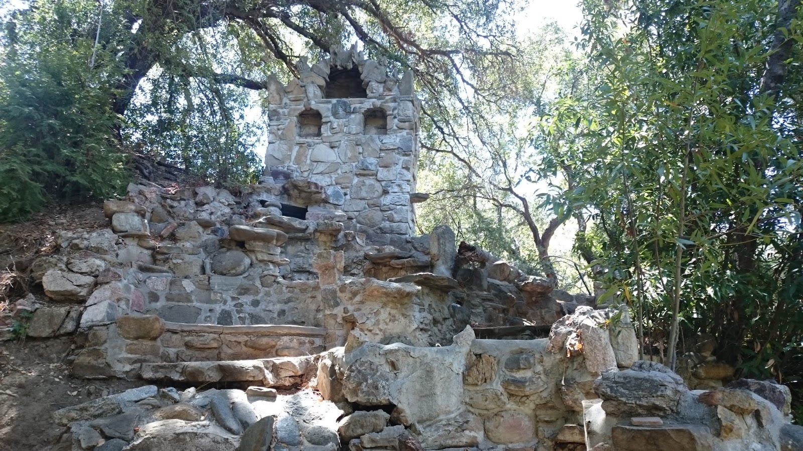

 After checking out the ruins we headed up to the little waterfall. It had just a slight trickle but was still a cool spot to visit. Just a note, dogs are not supposed to go past the ruins, so keep this in mind if you bring your furry friend.

Mila near the waterfall

The trickle at the falls

 After a short pitstop for a virtual cache, we headed down the easy, wide Solstice Canyon Trail back to the car. Found another tree with a hole to climb through on the way back as well. Fun spot to hike and easy enough to bring the whole family. Highly recommend this one.

Mila found another tree to climb through

Day 37: Wistful Vista Open Space


Day 37: Wistful Vista Open Space
Unmarked Trails
Wistful Vista Open Space- Oak Park, CA
Saturday, August 1st 2015
Time: 2 hours, 31 minutes
Pace: 37:15/mile
Distance: 4.06 miles
Elevation Gain: 621 Feet
Dogs Allowed?: Yes

Directions:
From the 101 Freeway in Thousand Oaks:
Exit Lindero Canyon Rd and drive north for 2.9 miles to Kanan Rd
Turn Right onto Kanan Rd and continue 1.2 miles to Oak Hills Dr
Turn Right onto Oak Hills Dr and the trailhead is on the right after 0.1 miles

Out collecting a few more geocaches on another hill I have not hiked in the Conejo Valley. Headed out here and followed the trail into a small creek area, the trail can be confusing to find but I made my way through and found the trail up the hill on the other side. Good views of Thousand Oaks and Oak Park up here, but I did not find the trail all that enjoyable. Very steep in sections, up and down, up and down, just not a very enjoyable experience.  Found all the caches and just hope I don't have to come up here again. Nothing really wrong with the trail, just personally didn't enjoy it.

 
Views of Thousand Oaks


Heading up the hill

Looking over Oak Park

Steep hills

Some nice sections of trail as well

Day 36: Ormond Beach


Day 36: Ormond Beach
Ormond Beach Loop
Ormond Beach- Oxnard, CA
Friday, July 31st 2015
Time: 40 minutes
Pace: 25:14/mile
Distance: 1.6 miles
Elevation Gain: 11 feet
Dogs Allowed?: No

Directions:
 From the 101 Freeway in Oxnard:
Exit Rice Ave and head south for 3.9 miles to CA-1
Keep right at the fork to continue on Rice Ave for 1.3 miles to Hueneme Rd
Turn right onto Hueneme Rd and continue for 0.9 miles to Arnold Rd
Turn left onto Arnold Road and continue 1.5 miles to the dead end. 
There is dirt parking on the side of the road. Walk straight down the road past the gate toward the beach

Today it was crazy hot up in Thousand Oaks so I headed down to the beach for a short hike around the short loop here. This is nesting habitat for the Snowy Plover, so no dogs allowed and much of the dunes area is fenced off for nesting. Lots of shorebirds here makes for a fun little hike.  

I headed down the main path to the beach and then headed north toward the power plant until I reached the trail that skirts back along the backside of the dunes and back to the car. Nice little 1.5 mile loop with a nice breeze and a relief after the heat up in Thousand Oaks.

Shorebirds

Looking back at the beach from the dunes

Heading through the dunes to the trail

The powerplant at the north end of the beach

The trail back along the back of the dunes

Protected habitat
 

Day 35: Rocky Oaks Loop Trail

Malibu Wine Country
Day# 35: Rocky Oaks Loop Trail
Rocky Oaks Loop Trail
Rocky Oaks Park- Malibu, CA
Thursday, July 30th 2015
Time:  28 minutes
Pace: 23:24/mile
Distance: 1.22 miles
Elevation Gain: 84 feet
Dogs Allowed?: Yes

Directions:
 From the 101 Freeway in Agoura Hills:
Exit Kanan Road and drive south for 6.1 miles to Mulholland Hwy
Turn Right onto Mulholland Hwy and make the first right into the parking lot 
Large parking area with bathrooms at the trailhead

Today I was looking for a short hike and a new geocache was published here so I headed up to this short loop.  Great views of the local wineries and a nice relaxing loop.  From the parking area I headed left and then took the loop clockwise around the park.  Easy day with a new earthcache found.

Turtle Rock

Rocky Oaks Estate Vineyard

Nice views of the vineyards along the trail

The meadow on the way back to the car
 

Day 34: Backbone Trail: Corral Canyon to Puerco Canyon


Day# 34: Backbone Trail: Corral Canyon to Puerco Canyon
Backbone Trail
Malibu Creek State Park - Malibu, CA 
Wednesday, July 29th 2015
Time: 4 hours, 28 minutes
Pace: 36:28/mile
Distance: 7.36 miles
Elevation Gain: 925 feet
Dogs Allowed?: No

Directions:
From Pacific Coast Highway in Malibu:
Head south on PCH for aprox. 2.2 miles to Corral Canyon Rd
Turn Left onto Corral Canyon Rd and continue approx. 5.2 miles to the trailhead.
Park in the large dirt lot at the very end of the road. Trailhead will be on the right side of the lot as you enter. 

Out doing another section of the Backbone Trail today, this time above Malibu along the Mesa Peak Motorway section. Started off the hike with a quick detour up the road to grab a couple geocaches, then backtracked down to start the actual Backbone trail. This area has some great rock formations and some interesting ruins of an old pool and house along the trail.  Great views along the whole trail down to the ocean.


Trail goes right over these rocks

Wind caves


Day 33: Backside of Ladyface


Day# 33: Backside of Ladyface
New trails on the southside of Ladyface Mountain
Agoura Hills, CA
Tuesday, July 28th 2015
Time: 2 hours, 34 minutes
Pace: 56:14/mile
Distance: 2.75 miles
Elevation Gain: 551 feet
Dogs allowed?: Yes

Directions:
From the 101 Freeway in Agoura Hills:
Exit Kanan Rd and head south for 2.0 miles to the trailhead on the right.  
Park in the large dirt area.

Looking for a quick hike before sunset today, I headed out to an area with a bunch of new geocaches on a pretty short stretch of trail. The slow pace on the hike was due to the climbing around the various spots to find the caches. The trail itself is easy and good for all ages, but the caches back here require some scrambling and steep climbs.  Had a lot of fun exploring back here and due to the long searches, ended up walking out by headlamp. A fun hike overall.

Heading up the trail

Views of Ladyface

Looking down toward Kanan Rd

Getting Dark

And its dark....
 

Tuesday, February 23, 2016

Day 32: Backbone Trail: Tapia Section


Day# 32: Backbone Trail: Tapia Section
Backbone Trail
Malibu Creek State Park - Calabasas, CA
Monday, July 27th 2015
Time: 3 hours, 15 minutes
Pace: 38:18/mile
Distance: 5.09 miles
Elevation Gain: 1419 feet
Dogs Allowed?: No

Directions:
From the 101 Freeway in Calabasas;
Exit Lost Hills Rd and head south for 1.1 miles to Las Virgenes Rd
Turn Right onto Las Virgenes Rd and continue for 3.4 miles to trailhead on right
Park in the large lot for the Backbone Trail. There is a small parking fee for this lot. You may be able to find street parking near Piuma Rd if you do not want to pay the parking fee.

Today I set out to complete another section of the Backbone Trail, this time from Las Virgenes Road heading west up to the next junction in the trail.  This is a pretty brutal climb up a fire road that is a really good workout for your legs. Great views up here of the canyons to the north and the ocean to the south.  I simply headed up to the top  of the hill where the trail meets up with another fire road and turned around and came back down hill from there. Good workout and a couple more miles of backbone completed.