Tuesday, March 8, 2016

Day 50: Cable Tower Hill


Day#50: Cable Tower Hill
Cable Tower Hill
Agoura Hills, CA
Friday, August 14th 2015
Time:  1 hour, 15 minutes
Pace: 35:50/mile
Distance: 2.1 miles
Elevation Gain: 419 feet
Dogs Ok?: Yes

Directions:
From the 101 Freeway in Agoura Hills:
Exit Reyes Adobe Rd and head north to Thousand Oaks Blvd
Turn Right onto Thousand Oaks Blvd and continue 0.9 miles to Grey Rock Rd
Turn Left onto Grey Rock Rd and continue 0.7 miles to Ridgeway Dr
Turn Left onto Ridgeway Drive and continue 0.2 miles to trailhead on left.
Park on the street, trail heads up the hill following the drainage canal

 Today was another quick hike to grab some more local geocaches I wanted to find.  I started out on Ridgeway Dr and headed up the little trail that follows the drainage canal until it meets up with the road heading to the top. I headed up the road to the top of the hill and then headed south on the trail until I reached the end. Just a short, quick hike with some excellent views of Agoura Hills and beyond.

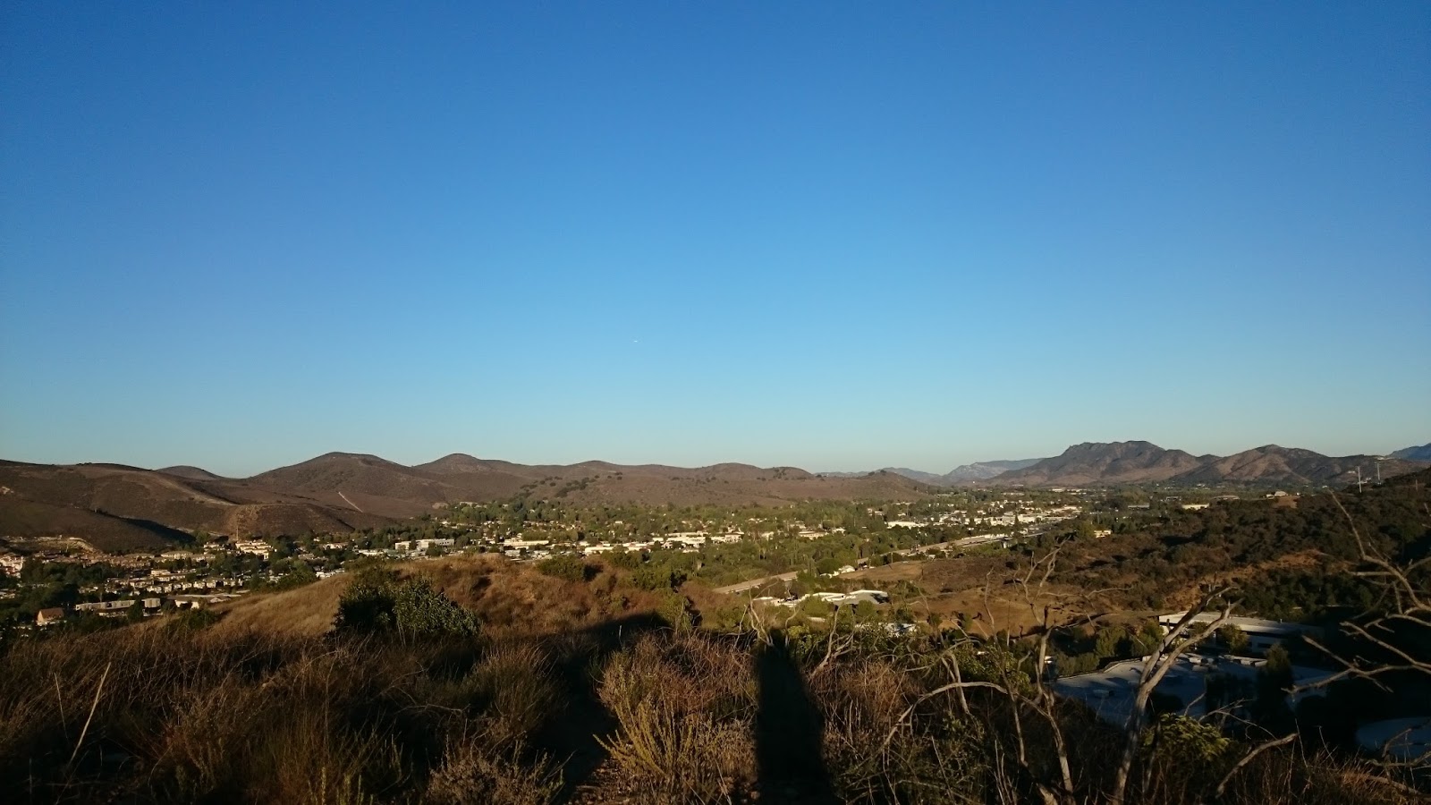
Views over Oak Park

Ladyface Mountain

Heading down the trail with great views of Ladyface
 

Wednesday, March 2, 2016

Day 49: Modelo Trail

Tons of Huge Oak Trees Here
Day# 49: Modelo Trail Loop
Modelo Trail/Palo Comado Canyon Trail/Chesebro Canyon Trail
Agoura Hills, CA
Thursday, August 13th 2015
Time:  1 hour, 38 minutes
Pace: 28:37/mile
Distance: 3.44 miles
Elevation Gain: 324 feet
Dogs Allowed?: Yes

Directions:
From the 101 Freeway in Agoura Hills:
Exit Chesebro Rd and head north on Palo Comado Canyon Rd
Turn Right onto Chesebro Rd and continue 0.7 miles to the entrance to Chesebro Canyon
Follow the dirt road into the parking area.  Information sign and restroom at the trailhead. 

Today I set out to get some information on some geocaches in the area so I planned a loop of the lower part of the Chesebro Canyon trail system.  I started in the main parking area and headed out on the Modelo Trail that heads due north from the parking area. This is a nice little trail that gives you some moderate elevation gain and some great views over the Conejo Valley. Once you climb the first hill, continue north on to stay on the Modelo Trail and follow it over the rolling hills of the ridgeline. 

Heading up the first climb

Looking north along the rolling ridgeline
 I followed the Modelo Trail north until it dead ends into the Palo Comado Canyon Trail.  I took a short side trip west on this trail for a cache, then turned back east and followed it down into Chesebro Canyon.  At the bottom of the hill you meet the Chesebro Canyon Trail. I turned right here and followed this through the beautiful canyon full of endless grasslands with giant oak trees dotting the landscape.  This trail leads all the way back to the parking area to complete the loop.  

County Line

Great oak trees down here

Heading through Chesebro Canyon

Rolling grasslands and Oak Trees as go on forever
 

Day 48: Unmarked Trail Near The Bay Club


Day# 48: Unmarked Trail from the Bay Club
Unmarked Trails
Thousand Oaks, CA
Wednesday, August 12th 2015
Time: 54 minutes
Pace: 51:20/mile
Distance: 1.06 miles
Elevation Gain: 223 feet
Dogs Allowed?: Yes

Directions:
From the 101 Freeway in Thousand Oaks:
Exit Hampshire Rd and head south to make an immediate right onto Willow Ln
After about 0.6 miles turn Left onto Conejo Ridge Ave
The Bay Club is the first parking lot on the right. Park in the far Northwest corner of the lot and the trail starts faintly from the edge of the parking lot.

Today I did not have much time for a hike, so I headed over to Thousand Oaks to a small hill area that had some geocaches on it and the faint old trails form a nice little 1 mile loop. I started off in the Bay Club parking lot and headed down the trail heading toward the freeway. The trail parallels the freeway for a bit, then turns steeply uphill to the top of the ridge.

Heading up the hill
At the top of the hill the trail intersects with another trail. If you turn right it will eventually meet up with the Los Robles trail system, but for today I turned left to loop back to the parking lot. A few wildflowers where blooming and the views of Thousand Oaks are pretty good up here. Not a bad hike for a quick 1 mile loop. 

Views of Thousand Oaks

The 101/23 interchange

Wildflowers in bloom
  

Tuesday, March 1, 2016

Day 47: Hollywood Beach

Marley heading down the beach
Day# 47: Hollywood Beach
Hollywood Beach
Oxnard, CA
Tuesday, August 11th 2015
Time: 35 minutes
Pace: 26:44/mile
Distance: 1.35 miles
Elevation Gain: 5 feet
Dogs Allowed?: Yes, except between 8am-5pm

Directions:
From the 101 Freeway in Ventura:
Exit Victoria Ave and head south for 5.4 miles to Channel Islands Blvd
Turn Right onto Channel Islands Blvd and continue for 0.5 miles to Channel Islands Blvd/Harbor Blvd
Use the Left Lane to turn Left onto Channel Islands Blvd/Harbor Blvd
Make a slight left to continue onto Harbor Blvd and drive 1.0 miles to Santa Ana Ave
Turn Right onto Santa Ana Ave and park at the end of the street.  There is beach access at the end of the street here.

Today was another very hot day in the Conejo Valley so I headed down to the beach for a short hike. My dog lives with my ex wife near here so I picked her up and we headed down the beach for a short little 1 mile trek.  Nothing too special here, just a walk down the beach with my dog. Had a fun time and she enjoyed running around in the sand.  On to the next one......


Day 46: Phantom Trail

Views over Calabasas
Day# 46: Phantom Trail
Phantom Trail
Malibu Creek State Park - Calabasas, CA
Monday, August 10th 2015
Time: 2 hours, 57 minutes
Pace: 38:23/mile
Distance: 4.62 miles
Elevation Gain: 680 feet
Dogs Allowed?: No

Directions:
Follow my directions for Day 14: Talepop Trail  

I was looking for another medium length hike in the Conejo Valley area and saw this trail that had a string of geocaches along it and decided to check it out. The trail starts on the Liberty Canyon Trail for a short while and then turns right on the Phantom Trail and heads up a great little canyon to the saddle on the ridge above.


After getting to the saddle I turned south and continued along the trail as it follows the ridge all the way to Mulholland Hwy. This is a great trail with nice views and is not too strenuous. As I continued along the ridge I encountered a large tarantula and some baby horned lizards.

Baby horned lizard

Large tarantula in the middle of the trail


After reaching Mulholland, I turned back and returned the way I came.  While coming down one of the steeper sections toward the end of the ridge, I saw a small snake in the trail up ahead. I was pleasantly surprised to find it was a young Southern Pacific Rattlesnake!  I have always loved rattlesnakes and this was a delight to see. He headed into a bush just off the trail and I was able to get into a gap in the bush for some nice photos of him. This was the highlight of the trip for sure.

Young Southern Pacific Rattlesnake

Closeup in the bush
After spending some time getting some pictures of the rattlesnake, I continued back down the canyon and headed back to the car. Great trip today with some fantastic animals on the trail.


Day 45: Lizard Rock/Wildwood Canyon Loop

Mila atop Lizard Rock
Day# 45: Lizard Rock/Wildwood Canyon Loop
Mesa Trail/Lizard Rock Trail/Wildwood Canyon Trail/Indian Creek Trail
Wildwood Regional Park- Thousand Oaks, CA
Sunday, August 9th 2015
Time: 3 hours, 21 minutes
Pace: 43:34/mile
Distance: 4.62 miles
Elevation Gain: 543 feet
Dogs allowed?: Yes

Directions:
Follow the directions from Day 3: Wildwood Canyon/Lynnmere Trail  

Today was another hike with my niece and sister around Wildwood Park. I wanted to go to a different spot since they hike here frequently, but Mila really wanted to go to the waterfall so we decided to just take a different route to get there.  We set out from the main trailhead at Wildwood Park and headed straight down the Mesa trail to Lizard Rock.  Had some fun climbing the rock for some photos as seen above and took a quick rest break here.

Looking over Wildwood Park from Lizard Rock
 After our short break here, we headed back down to the main trail and continued along the Lizard Rock Trail down the switchbacks toward the Hill Canyon Water Treatment Plant. This is a nice winding trail down the hill to the bottom of Wildwood Canyon.  From the bottom we continued along the Wildwood Canyon trail until we reached Paradise Falls. This spot is my nieces favorite spot to come to.  We took another break here and let Colby (my sisters dog) and Mila play around in the water for a while and enjoyed a snack.  

Enjoying the shade and the creek at Paradise Falls
After some fun at the falls, we continued up the Wildwood Canyon Trail to the Indian Creek trail and followed that out of the canyon to the car.  A great shady trail that follows the creek all the way back toward the parking lot.  Along the way we spotted a lizard and Mila went in for a closer look.

Mila checking out a lizard
 

Day 44: Saddle Pass Trail

Looking over the new Westlake YMCA
Day# 44: Saddle Pass Trail
Saddle Pass Trail
Westlake Village, CA
Saturday, August 8th 2015
Time: 1 hour, 49 minutes
Pace: 34:51/mile
Distance: 3.15 miles
Elevation Gain: 606 feet
Dogs allowed?: Yes

Directions:
From the 101 Freeway in Westlake Villlage:
Exit Lindero Canyon Rd and head north for 1.3 miles to Hedgewall Dr
Turn Left onto Hedgewall Dr and continue for 0.3 miles until it turns into Landino Dr
Park on the street. The trail starts in the northwest corner of the small park here.

Today I was out for a short hike before work to grab a few more geocaches I needed in the area. I started in the park at the corner of Landino Dr and Hedgewall Dr and headed up the steep trail leading out of the corner of the park.

Steep Trail
After a short but very steep climb, I arrived at the top of the hill and reached a junction in the trail. From here I headed south toward the edge of the hills. I continued down until the trail dead ends at the new Westlake YMCA that is being built. I turned around here and went back down the way I came and barely got back in time to get to work. I was expecting this to be closer to 2 miles, but I made it just in time for work. 

Nice short trail for a good leg workout with the steep hills and some nice views of the Conejo Valley from the top.  

Looking down the trail from the top of the first climb