 |
| Paradise Falls |
Woodridge Loop Trail
Thousand Oaks, CA
Saturday June 27th 2015
Time: 1 hour, 34 minutes
Pace: 28:43/mile
Distance: 3.30 miles
Elevation Gain: 365 feet
Directions:
From the 23 Freeway in Thousand Oaks:
Exit Sunset Hills Blvd and head east for 2 miles to the parking area on the right
Parking is a free gravel lot.
Trail begins across the street and ends the loop in the parking area. I did not take any pictures on this hike today as I was not originally planning to make this into a blog. I just did a loop of the main Woodridge Trail, which loops around the housing development here. This is a well maintained and easy trail for all ages.
Day #3: Wildwood Canyon/Lynnmere Trail
Indian Creek/Wildwood Canyon/Lynnmere Trails
Wildwood Regional Park, Thousand Oaks, CA
Sunday June 28th 2015
Time: 2 hours, 31 minutes
Pace: 40:02/mile
Distance: 3.79 miles
Elevation Gain: 383 feet
Directions:
From the 101 Freeway in Thousand Oaks:
Exit Lynn Road and head north for 3.7 miles to Avenida De Los Arboles
Turn Left onto Avenida De Los Arboles and continue for 1.0 mile to the parking area on the left at the end of the road.
Parking is a free dirt lot.
From the lot the Indian Creek trail heads east following the road for a bit before turning right and heading down toward Wildwood Canyon. I was hiking with my sister and my niece today, so we stopped at the Indian Cave on the way down to play around for a little bit.
 |
| My sister and my niece at the Indian Cave |
 |
| Mila at Paradise Falls |
Day #4: CLU Cross
Unmarked trails on the California Lutheran University Campus
California Lutheran University- Thousand Oaks, CA
Monday, June 29th 2015
Time: 1 hour, 13 minutes
Pace: 41:48/mile
Distance: 1.77 miles
Elevation Gain: 186 feet
Directions:
From the 23 freeway in Thousand Oaks:
Exit Sunset Hills Blvd and head west for 0.9 miles to Olsen Road
Turn Left on Olsen Road and continue for 1.4 miles to Campus Drive
Turn Right onto Campus Drive and follow it 0.5 miles to Bainbridge Ct.
Turn Right onto Bainbridge Ct and follow it 466 feet to the end of the cul-de-sac.
Park on the street and follow the trail heading east.
Today I decided to explore the area around the CLU cross and some of the other side trails to form a loop of the area. I began by parking on Bainbridge Court and followed the trail heading Northeast toward the cross.
 |
| Heading toward the cross |
 |
| The CLU Cross |
 | |||||
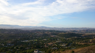
| Looking north toward Santa Rosa Valley |
After visiting the cross and snapping a few photos, I turned west on the trail following the ridgeline all the way to the neighborhood. After finding the geocaches at this end of the trail, I followed the lower trail that runs at the base of the hill I just came across and followed this trail back to my car at the starting point. Quick easy hike to find a few geocaches.
 |
| Sunset over Santa Rosa Valley |
No comments:
Post a Comment