Monday, February 29, 2016

Day 43: Parker Mesa Overlook


Day# 43: Parker Mesa Overlook
Hau'oli Trail/Parker Mesa Trail/Paseo Miramar Trail/Los Liones Canyon Trail
Friday, August 7th 2015
Time: 3 hours, 42 minutes
Pace: 41:11/mile
Distance: 5.40 miles
Elevation Gain: 1302 feet
Dogs Allowed?: No

Directions:  
From Pacific Coast Hwy in Santa Monica:
Drive north on PCH for 4.4 miles to Sunset Blvd
Turn Right onto Sunset Blvd and continue 0.3 miles to Los Liones Dr
Turn Left onto Los Liones Dr and continue 0.5 miles to trailhead on right.
There is a large parking lot on the right side of the road with restrooms at the trailhead.

Today I set out to tackle another one of the peaks in the Santa Monica Mountains. Today I was heading to Parker Mesa Overlook. This spot has amazing coastal views over the Santa Monica Bay.  I wanted to make a loop out of this so I started off on the Hau'oli Trail.  This is not an official trail and is a bit hidden, look for the small use trail heading northwest right near the start of the Los Liones Trail. This trail is extremely steep in places and not good for children.

Looking back after the first part of the ascent

How and why would someone drag a couch up here?????

Much of the trail is under the bushes in a tunnel like fashion

Looking at what is to come

Steep, rocky and loose. This would be dangerous to come down


After the grueling climb up this trail, I finally reached the Parker Mesa Overlook.  There is a bench to rest and enjoy the sweeping coastal views. There was a few people here, so I just took some pictures and headed off down the Parker Mesa Overlook Trail to connect to the Paseo Mirimar Trail and head back down the mountain.

 
Parker Mesa Overlook Trail


Heading down the Paseo Miramar Trail

Views of Santa Monica below


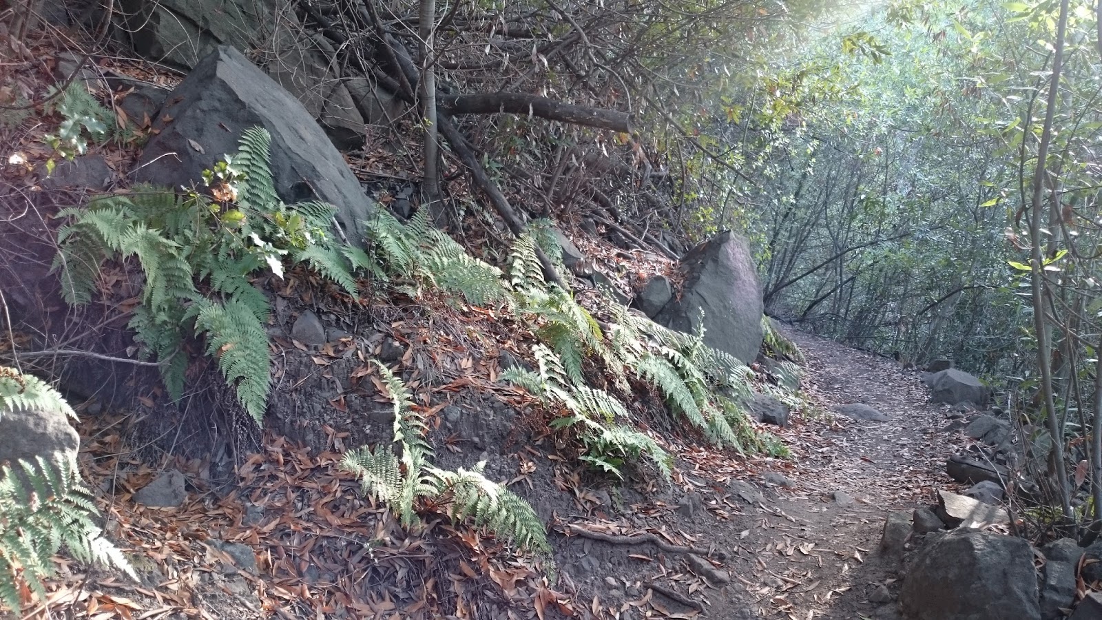
The Paseo Miramar Trail is a fire road that heads down toward Pacific Palisades and is the main way most people take to get up to Parker Mesa.  It was a relaxing walk down the mountain after the crazy climb straight up the side.  Near the bottom of the trail on the righthand side will be the Los Liones Trail. This will take you back to the car on a great little winding singletrack through the canyons.

Starting down the Los Liones Trail

Fun singletrack trail

Lush little canyons


Great hike, lots of geocaches found, and one more peak scratched off the list. I call that a successful day!  

Day 42: Malibu Creek State Park


Day# 42: Malibu Creek State Park
Cistern Trail/Lookout Trail/Yearling Trail/Deerleg Trail/Crag Road/Forest Trail
Malibu Creek State Park - Calabasas, CA
Thursday, August 6th 2015
Time: 3 hours, 35 minutes
Pace: 49:34/mile
Distance: 4.35 miles
Elevation Gain: 533 Feet
Dogs Allowed?: No

Directions:
From the 101 Freeway in Agoura Hills:
Exit Kanan Rd and head south for 0.4 miles to Cornell Way
Turn Left onto Cornell Way and drive 2.3 miles to Mulholland Hwy
Turn Left onto Mulholland Hwy and continue 1.4 miles to a dirt turnout on the right side. Trail starts from the turnout. Be sure you are all the way off the road.

Looking into the canyon from the top
Today I headed out on a loop of Malibu Creek State Park to grab a bunch of geocaches I was missing. I started on the Cistern Trail that begins on Mulholland Hwy to avoid having to pay the parking fee when you park inside the actual park.  I headed down the trail and made a right on the Lookout Trail, this takes you into a grassy meadow area where you connect to the Yearling Trail. I then connected onto the Deer Leg trail that takes you into a nice oak forest area. After finding the final cache on this trail, I headed back to the Yearling trail and took it down into the canyon.

Along the Deer Leg Trail

At the bottom, I headed left on Crag Road to connect to the Forest Trail. Crag is the main trail through the park and is the jumping off point for several good hikes in this area. I took the forest trail to the very end where it dead ends into the Century Dam.  There where several people enjoying the day swimming in the lake here.  I really enjoyed this trail as it is true to its name and takes you through a redwood forest, not something you would normally do in Southern California.

Heading into the forest

Redwood Tree

More redwoods

Trail runs right along Century Lake

Shaded trail with views of the lake, what more can you ask for?

The forest trail is a dead end, so from here I retraced my steps to Crag Road and headed back toward the car. I took the Lookout Trail back to the Cistern trail and finally back to Mulholland to my car. Nice little loop and no parking fees!

Horned Lizard

Looking back toward Century Dam from the Lookout Trail

Another baby Horned Lizard on the way up toward the car

Day 41: Reyes Peak Trail

View from Reyes Peak looking toward Ventura

Day# 41: Reyes Peak Trail
Reyes Peak Trail
Pine Mountain - Los Padres National Forest, CA
Wednesday, August 5th 2015
Time: 2 hours, 34 minutes
Pace: 41:47/mile
Distance: 3.69 miles
Elevation Gain: 715 feet
Dogs Allowed?: Yes

Directions:
Follow directions from Day 40: Raspberry Spring Trail
Continue past the Reyes Peak Campground to the end of the road where the trailhead begins in a dirt parking area. This road is a bit rough but I was able to drive to it in my Mazda 3

Map at the trailhead


Today was our second day on Pine Mountain and the flies where driving us absolutely crazy by now. My two friends could not take it anymore and decided to lay low in their tent until sundown to avoid the flies. To be fair, there where a TON of flies, but that wasn't going to ruin my hike. 

I headed down to the end of the road and set out on the trail. My dog Marley wasn't acting herself and seemed a little low on energy so I left her back at camp to rest with the guys.  Anyway, I started out heading straight down the trail. After a short while, you will come to a 3-way junction.  If you continue straight, as I did, it takes you to Reyes Peak. It is steep initially, but evens out and is a fantastic little trail to unbeatable views. 

Views looking north on the way up

Wildflowers along the trail

Looking toward Lockwood Valley

Views all the way to the ocean

Love the pine forests up here

Spectacular Views

Looking back toward camp, the road you see is the road you drove in on

Benchmark at the peak
 After finding the cache at the peak and locating both benchmarks, I headed back down the way I came to the 3-way intersection and headed north. This part of the trail is a great little trail that goes around the peak and eventually leads down to Haddock Camp, but today I just went a mile or so down the trail and headed back to camp. I figured I wouldn't keep my friends waiting too long so I kept it short and sweet today. By the way....the flies where almost nonexistent on the trail, I guess they should have come for the hike :P


Looking north


Thursday, February 25, 2016

Day 40: Raspberry Spring Trail

The view from Reyes Peak Campground
Day# 40: Raspberry Spring Trail
Raspberry Spring Trail
Los Padres National Forest
Tuesday, August 4th 2015
Time: 50 minutes
Pace: 42:26/mile
Distance: 1.20 miles
Elevation Gain: 332 feet
Dogs Allowed?: Yes

Directions:
From the 101 Freeway in Ventura:
 Take the Ca-33 North for 72.4 miles to Pine Mountain Ridge Rd
Turn Right and continue for 5.7 miles to trail on left.
Trail starts at a campsite in Reyes Peak Campground. Park in a campsite and display your Adventure Pass.

My friend was down visiting from Sacramento so we decided to spend the weekend up on Pine Mountain and camp at Reyes Peak.  After setting up camp at the next spot over from where the trail begins, we headed down to Raspberry Spring for a short little hike before settling in for the night.  This is a very short, but very steep trail down to a nice spring.  There is also a campsite at the spring if you wanted to hike in to camp.  We did not try the water but I am told this is some of the best tasting water in the Los Padres.

Marley is enjoying the forest

Nice trail through the pines

View north from the springs

Some massive trees up here
 After a short break at the spring, we headed back up the trail. My friend does not hike much, so this steep incline at this altitude was tough for him, but we made it back slowly and went back to camp for some dinner and beer. Great night out here in the forest and a place I will be coming back to explore more of later.

Heading back up the hill

Marley loves it out here

Nice change of scenery from my normal chaparral hikes

My friends ridiculously large tent, and my little single tent behind
 

Day 39: Backbone Trail: Hondo Canyon


Day 39: Backbone Trail: Hondo Canyon
Backbone Trail
Topanga State Park- Topanga, CA
Monday, August 3rd 2015
Time: 5 hours, 11 minutes
Pace: 44:19/mile
Distance: 7.03 miles
Elevation Gain: 1457 feet
Dogs allowed?: No

Directions:
From the 101 Freeway in Calabasas: 
 Exit Ventura Blvd/Topanga Canyon and merge onto Ventura Blvd
Continue on Ventura Blvd for 0.3 miles to Topanga Canyon Blvd
Continue for 8.0 miles to Old Topanga Canyon Rd
Turn Right onto Old Topanga Canyon Rd and continue 0.4 miles to parking on Left
Large dirt pullout will be on the left just past a horse crossing sign and small bridge.
Trail starts at the dirt pulloff

 Another day on the Backbone Trail. This section through Hondo Canyon has to be one of my favorite parts of this trail. You start off heading through some small meadows and then begin climbing up the canyon. Some great Oak and Bay tree forests through here make for a great shady hike with spectacular scenery. 

Beginning of the trail through the oaks

Heading up and out of the meadows

Great oak forests

Views of the canyon

Into the Bay Trees

Basking in the sun

More Oak forest

Ferns along the trail

Amazing views

Just a great trail


Why would people graffiti on a hiking trail...I don't get it

Views from the top

Found this guy hopping along the trail as it was getting dark