Monday, July 18, 2016

Day 61: Lynnmere Trail

Day# 61: Lynnmere Trail
Lynnmere Trail
Arroyo Conejo Open Space - Thousand Oaks, CA 
Tuesday, August 25th, 2015
Time:  51 minutes
Pace: 31:40/mile
Distance: 1.64 miles
Elevation Gain: 109 feet
Dogs Ok? Yes

Directions:
From the 101 freeway in Thousand Oaks:
Take the Lynn Road exit and head north on Lynn Road for 1.3 miles
Turn left onto Camino Manzanas and continue 0.3 miles to Camino Magenta
Turn Right onto Camino Magenta and continue 0.3 miles to dead end.
Park on the street, trail starts at the dead end.


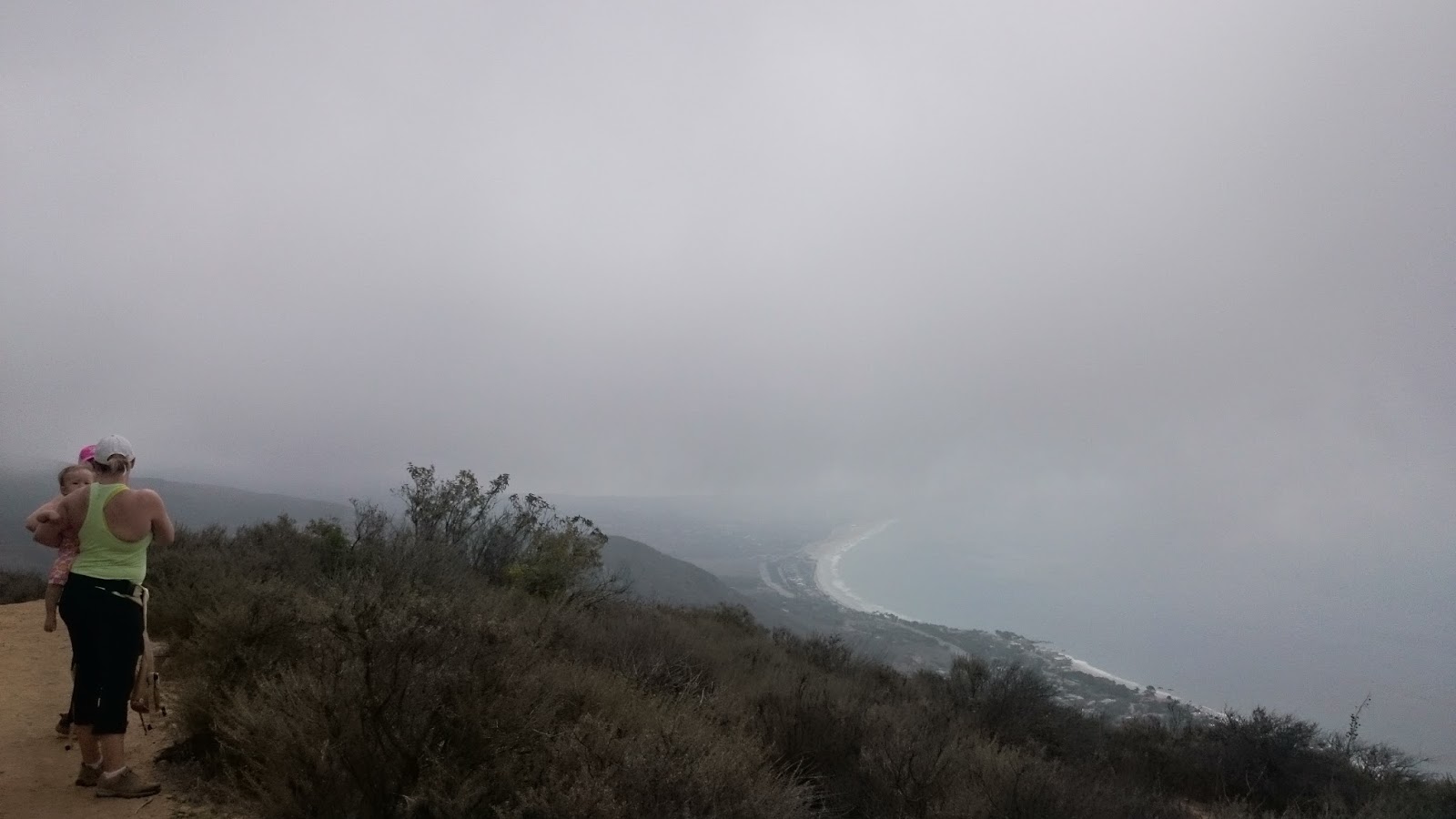
Today was just a quick local hike after work.  I headed up to Lynn Ranch and did a quick mile and a half along the ridgeline on the Lynnmere Trail.  This is a great trail if you are looking for some stunning views of the city with very minimal effort.
The trail starts at the dead end of Camino Magenta and heads uphill on a paved road until you hit the trail on your left.

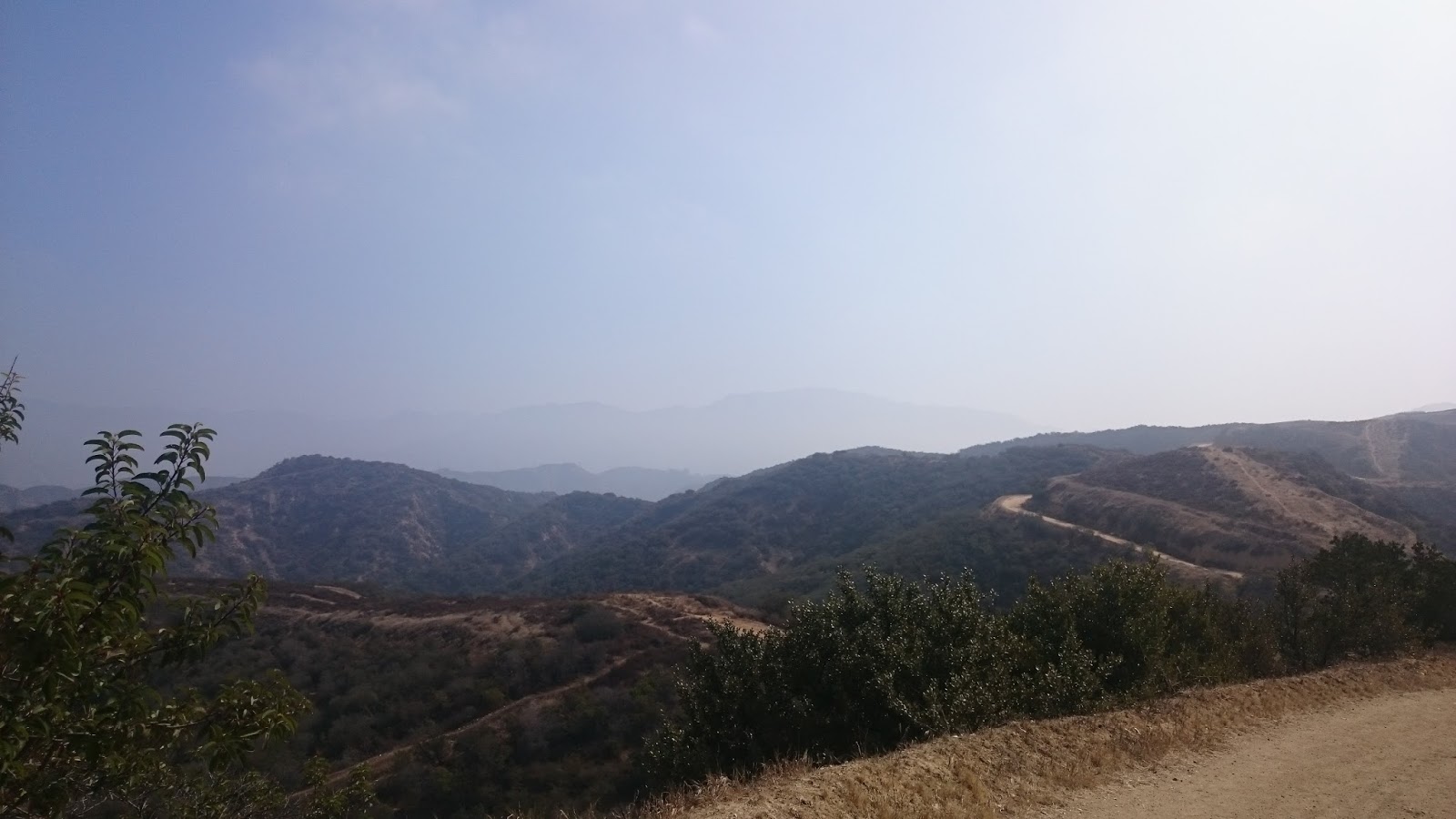
Following the trail left it meanders along the ridgeline on a well maintained trail that is easy for all ages and offers great views of Thousand Oaks.

I turned around at the end of the ridge, but you are able to continue down some switchbacks and connect to the main Lynnmere trail that heads toward Wildwood Park
 
Wildwood Park off the the right


Trail continues down some switchbacks here

Side blotched lizard getting some sun

Day 60: Mandalay Beach


Day# 60: Mandalay Beach
Mandalay Beach - Oxnard, CA
Monday, August 24th, 2015
Time: 41 minutes
Pace: 27:03/mile
Distance: 1.53 miles
Elevation Gain: 33 feet
Dogs OK? Yes

Directions:
From the US-101 in Ventura:
Exit Victoria Ave and head south on Victoria Ave for 4 miles
Turn right onto W. 5th St and continue for 1.5 miles to the beach.
Park on the street.

Today was another super hot day so I headed down to the beach and picked up my dog to go explore a new beach that I had not been to yet.

We parked at the end of 5th Street and followed the beach south for about three quarters of a mile and then returned along the shoreline to get our feet wet. Marlee had a great time and this was a nice way to beat the heat of the Conejo Valley for the day.


Day 59: Charmlee Wilderness Park Loop

Heading down the trail with the family

Day# 59: Charmlee Wilderness Park 

Potrero/Ocean View/E. Meadow Trails
Charmlee Wilderness Park - Malibu, CA
Sunday, August 23rd, 2015
Time: 1 hour, 45 minutes
Pace: 44:16/min per mile
Distance: 2.39 miles
Elevation Gain: 345 feet 
Dogs OK?: Yes

Directions:
From the US-101 in Thousand Oaks:
Take the Westlake Blvd/CA-23 S exit and head south on Westlake Blvd
Continue on Westlake Blvd for 7.9 miles to Lechusa Rd
Turn left onto Lechusa Rd and continue onto Encinal Canyon Rd for 1.2 miles to park entrance on the right.
Park in the lot and don't forget to pay the iron ranger.

Today I wanted to go for a hike and take my sister and my nieces over to my work at Malibu Wines to check out the animals. I have been to Charmlee before and knew that it would make a nice family hike with some ocean views and easy trails.  Our friend Jen and her mom wanted to see the animals too so they decided to come along for the hike.

We started out down the Potrero Trail toward the ocean where we connected to the Ocean View trail to loop around to the ocean overlook.  Great weather and although there was a marine layer the views of Malibu where impressive nonetheless.
My sister with my youngest niece Ella at the overlook

After the overlook we looped around to the E. Meadow Trail and headed through some beautiful oak forests and grassy meadows back to the car.

Mila climbing around on the boulders

Sunday, March 27, 2016

Day 58: Chandler Fire Road

Burbank Airport from above
Day# 58: Chandler Fire Road
Chandler Fire Road
Verdugo Mountain Park-Sun Valley, CA
Saturday, August 22nd 2015
Time:  59 minutes
Pace: 25:06/mile
Distance: 2.36 miles
Elevation Gain: 568 feet
Dogs OK?: Yes

Directions:  
From the 5 Freeway(Southbound) in Sun Valley:
 Exit Sunland Blvd and continue onto Roscoe Blvd for 0.4 miles, then stay left on Roscoe Blvd
Turn Right onto Glenoaks Blvd and continue 0.4 miles to Lanark St
Turn Left onto Lanark St and continue 0.5 miles to Edmore Pl 
After 0.2 miles the trailhead begins at the deadend of Edmore Pl
Park on the street

Today I had to drop my Aunt who was visting from New Mexico off at Burbank Airport so I figured this would be a good chance to hike outside my normal area and find a new place. Before we left I looked at some maps and found Verdugo Mountain Park right on the other side of the freeway from the airport. I loaded in the information for the geocaches in the area and went to the airport to drop off Aunt Sue.

Sign at the trailhead....sounds fun
 After dropping her off at the airport I made my way through the neighborhoods to the trailhead. Parking was not a problem and I made my way onto the trail.  The trail is basically just a fire road that heads steeply up to the top of these mountains. I had to be at work later today, so I went a little more than a mile up and then headed back down.  Lots of people on the trails, but the views of the Los Angeles area where nice and it was interesting to see the airport from a birds eye view.

Heading up into the Verdugos


Heading back down toward the city
 

Day 57: Serenata Trail


Day# 57: Serenata Trail
Serenata Trail
Moorpark, CA
Friday, August 21st 2015
Time:  1 hour, 11 minutes
Pace: 31:36/mile
Distance: 2.25 miles
Elevation Gain: 222 Feet
Dogs Ok?: Yes

Directions:
From the 23 Freeway in Moorpark:
Exit Tierra Rejada Rd and head West 0.7 miles to Miller Parkway
Turn Right onto Miller Parkway and continue 0.6 miles to Miller Park, on right
Park in the parking lot for the park and walk northeast across the fields to the trailhead at the corner of the fields.


Today I needed a short hike and I had been eyeing a geocache in the area that took you through a tunnel under the freeway and it sounded like a fun little adventure. So I headed out to Moorpark and located the trail starting in Miller Park. After walking across the little park I headed downhill on the trail where I headed east toward the freeway. After picking my way through the network of trails and jumps for BMX bikes down here, I found the tunnel.


I made sure to bring a flashlight as I knew it would be dark in here and it was. It is always fun to find these tunnels that lead to areas that you normally would have no access to. All the land surrounding the area on the other side is private property, so this is literally the only way to access this area. 

After getting to the other side, I searched around and found the geocache I was searching for. I wandered a bit and checked out the area, but I didn't go too far as to not accidentally wander onto private property.

The other side of the freeway

After heading back through the tunnel I made my way back to the trailhead and then continued south along the fields to the other part of the trail that heads up along the hills above the park.  This is mostly a nice singletrack trail with some nice views of Moorpark and was an enjoyable hike.  I made a loop up here and then headed back down to the car. Easy hike with some extra fun factor of a tunnel on it made this a great day.

Prickly Pear

Overlooking Miller Park

Looking south at the farm fields of Moorpark

Heading along the ridge

Return down the switchbacks

Friday, March 18, 2016

Day 56: Ranch Center Trail

View from the top
Day# 56: Ranch Center Trail
Palo Comado Canyon Trail/Ranch Center Trail
Chesebro Canyon- Oak Park, CA
Thursday, August 20th 2015
Time: 1 hour, 46 minutes
Pace: 27:44/mile
Distance: 3.83 miles
Elevation Gain: 1011 feet
Dogs Allowed?: Yes

Directions:
From the 101 Freeway in Agoura Hills:
Exit Kanan Rd and drive north for 2.3 miles to Sunnycrest Dr
Turn Right onto Sunnycrest Dr and continue 0.6 miles to Doubletree Rd
Sunnycrest Dr turns into Doubletree Rd and then you continue 0.1 miles to trailhead on right.
Park on the street

Today I spend another day gathering information for some geocaches in the area. These ones are multi-caches, meaning you have to visit more than one location to find them. On this hike, I would just be gathering the information for where to find the final locations of these caches.

I started my hike on Doubletree Rd at the trailhead simply marked Public Recreation Trail.  I headed down the trail toward Palo Comado Canyon and made a right once I got the the bottom of the hill.  I then turned left onto Ranch Center Trail and followed it up and over the hill to Chesebro Canyon, with a side trip to the peak at the crest of the trail.  This was a steep climb and was really tough in the heat today.  

Palo Comado Canyon

The top of Ranch Center Rd

Great canyon views to the north
 
Looking west back down the little side trail to the peak


After arriving at the peak, I headed to the final 2 caches which where at the bottom of the next hill in Chesebro Canyon.  I knew that by doing this I would have to climb back up and over on the way out.  This turned out to be a pretty tough climb from this side as well and I was pretty worn out by then end of this short hike.

Chesebro Canyon

Great views, but a lot of work to get to them.... 

Day 55: Hidden Valley Overlook Trail

Looking over HiddenValley
Day# 55: Hidden Valley Overlook Trail
Wendy Trail/Satwiwa Loop Trail/Hidden Valley Overlook Trail
Rancho Sierra Vista/Satwiwa-Newbury Park, CA
Wednesday, August 19th 2015
Time: 2 hours, 35 minutes
Pace: 31:48/mile
Distance: 4.87 miles
Elevation Gain: 830 feet
Dogs Allowed?: No

Directions:
From the 101 Freeway in Thousand Oaks:
Exit Lynn Road and drive west for 3.9 miles to Wendy Dr
Turn Left onto Wendy Dr and continue 0.6 miles until it dead ends at Potrero Rd. 
Park in the large dirt area directly across Potrero and the trail starts in this parking area.

A nice day in the Conejo Valley so I decided to check out a trail I have walked past many times but never actually ventured up.  I started in the parking area at Wendy Dr and headed down the Wendy Trail toward the windmill.

Heading toward Old Boney, stay left at this fork
 
 After passing the windmill I continued straight onto the Satwiwa Loop Trail to the top of the hill where it connects to the Hidden Valley Overlook Trail. From here the real climb begins.

Really cool burnt oak forest just after the windmill

Once at the top of the main climb you emerge to a great view of Hidden Valley in front of you.  Behind you is a great view back to Satwiwa and the meadows below.  

 
The Old Boney Trail snaking up the mountain


Getting some sun

The Hidden Valley Overlook Trail

 I headed down a use trail from here climbing up the mountain a bit more on a very narrow track through the chaparral.  I was heading toward 3 caches out here that are a bit out of the way but the journey was worth it.

Once at my destination, you see some signs for Mountain Lion monitoring site and this is an area where they have apparently trapped mountain lions for research and to put radio collars on them.. It is a spooky feeling being all alone in dense chaparral knowing that this is an area the lions probably frequent. You really get the feeling you are being watched by something in the bushes here....

After failing to find the cache at this location...probably due to the overall sense of urgency to get the hell out of here, I headed to one final cache location and then back down the mountain.  A cool adventure for sure, although I feel like next time I come out here may be with more people for a better sense of security.


I enjoyed a fantastic sunset on the way back down the mountain and was treated to seeing several deer grazing in the meadows on the way back to the car. One even let me get within about 30 feet of it....way cool.  After taking some pictures of the deer it was an easy stroll back to the car just as it was getting dark. 

The Windmill

Deer on the way to the car